

[Disaster Reduction Topics]: “Wind Chasers Too” | bavi Life Cycle
![[Disaster Reduction Topics]: “Wind Chasers Too” | bavi Life Cycle](https://images.bitpush.news/2026/07/special_cn-20260711-178378455819524194.jpg:WechatIMG3741.jpg)
Without a written screenplay, the shock that Bawe brought would probably be overlooked by many, because it shook over and over again as it weakened — almost collapsed — and re-strengthened, even more so than the shock in the capital market.
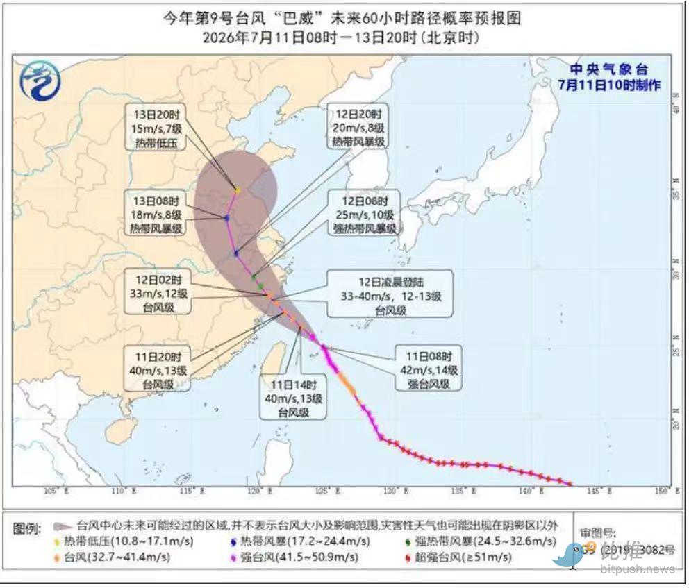
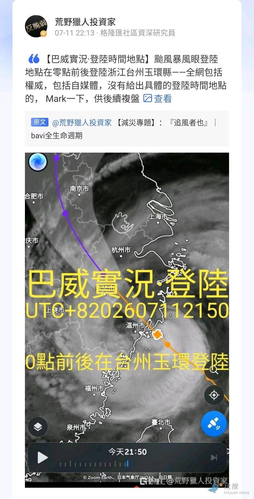
From the National Defense Administration to disaster prevention and mitigation departments at various levels, the weather disaster forecast forecast site and people along the route may constantly feel the oppression from the real feeling of the physical world (the rain has not returned, the wind and air pressure have changed markedly) and the tension on the news side heats up. At the beginning of July, the strategy team designated the early Q3 as the “disaster mitigation” [EI NINO review] At this time, when the whole process was recorded, the potential impact of Bawe on people's lives and capital markets the moment before and after landing Reporting and analysis.
The points worth recording in the current collection:
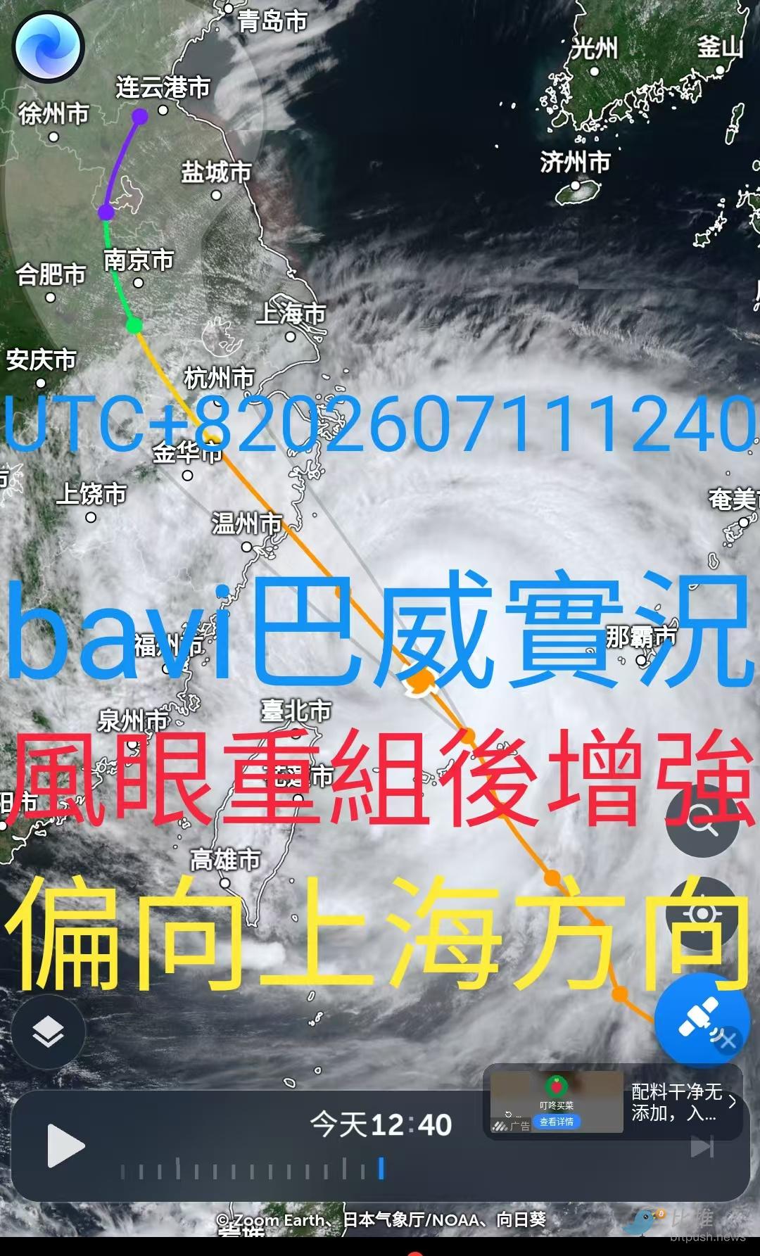
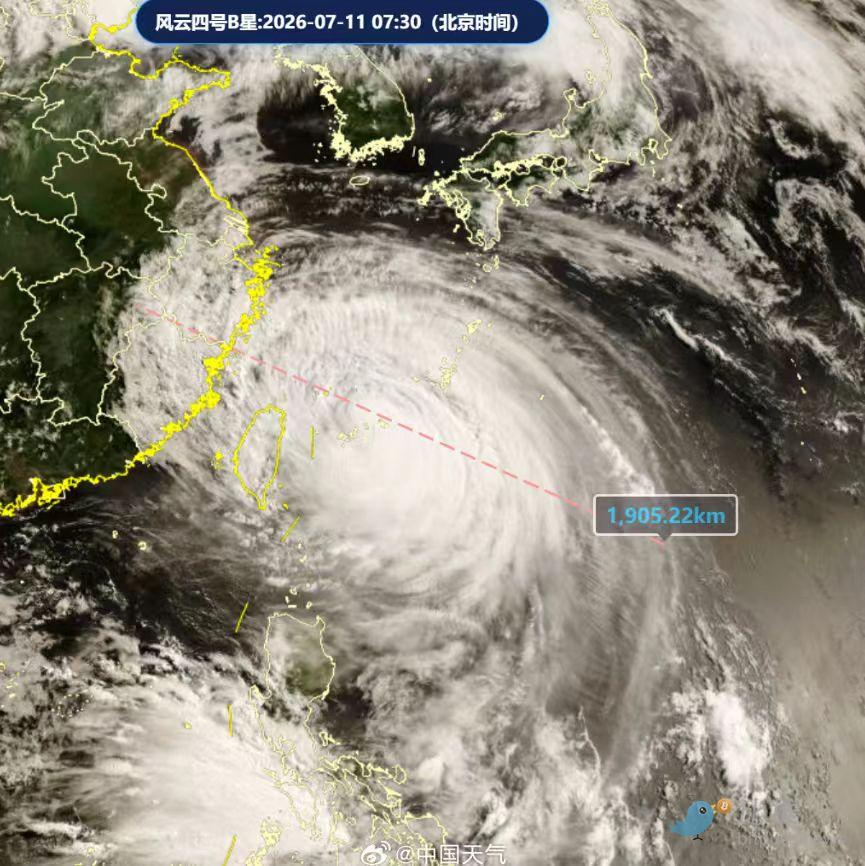
1 The core of the typhoon circled the Central Mountains of Taiwan Island (escaping the weakened first barrier),
2. The typhoon eye, which disappeared before, has now been restructured (eye wall replacement) and strengthened, and the power scale has been lowered from level 14 and raised again.
3. Meteorological technology, the drive-heat air drawn in from the northwest direction has definitely weakened Bawe's outer cloud belt, but it has now been repaired. It has more heat, more water vapor, and larger volume.
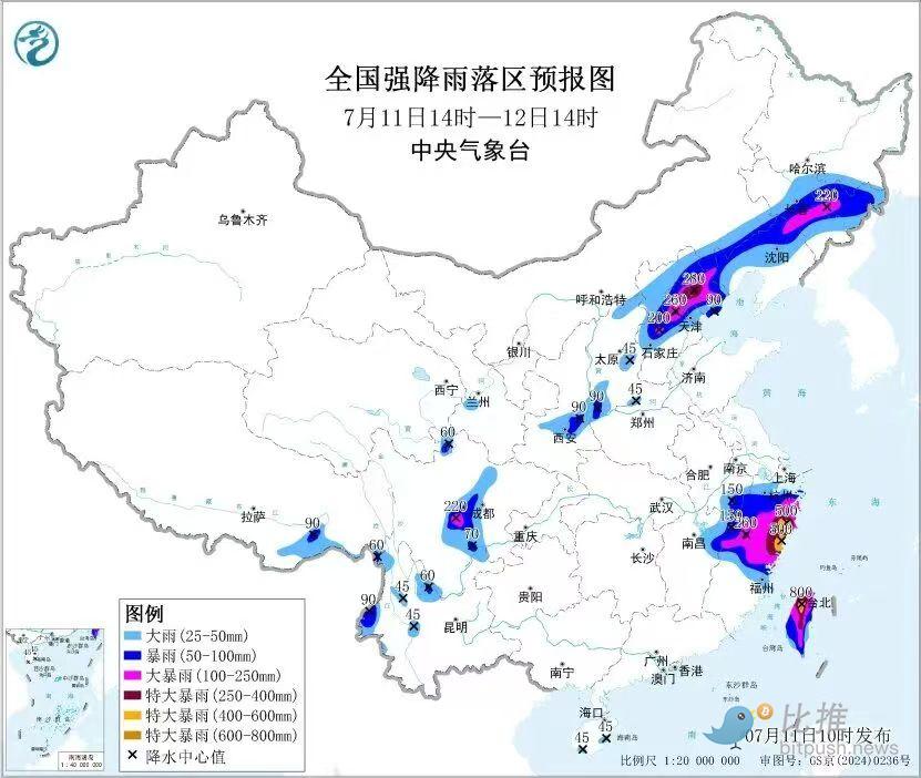
4. Due to its continuous increase in volume, it is in contact with the north-west side height and the southwest monsoon, driving the balance. It is expected that it will continue to bring rainfall to Guangxi. Currently, it has formed a relatively strong rainfall in some regions of Sichuan.
Overcoming the center of the storm will cause a sharp drop in air pressure and a short period of no wind or rain. It does not mean that the danger will be lifted. This means that there will be huge instantaneous strong convection after a short period of time. Friends in mountainous areas must pay attention to mudslides and landslides.
The Central Meteorological Observatory issued the first red warning for rainstorms this year, except in areas where the typhoon directly landed. Outside of its far end, the only radar echoes in the southern part of Northeast China and Sichuan, which can be reached by the cloud system/vice-high in opposition to the cessation and monsoon traction, are very clear
If people don't understand enough about this, don't take it lightly. If you're bored at home, and don't want to watch a game, you can revisit some Hollywood movies related to the typhoon, such as Typhoon Rescue, The Day After Tomorrow, etc.
Satellite live data is collected approximately every 2 hours. It is beneficial or simply due to one's own safety considerations, and can be understood in a timely manner
When the wind blows up, regardless of whether it's high or low, close doors and windows